


Car-Dependent
12
Walk Score ®
Out of 100
Walking is difficult in this neighborhood, which is considered a car-dependent area.

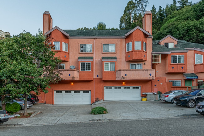
150 Caldecott Ln, Oakland, CA 94618
150 Caldecott Ln, Oakland, CA 94618
Url: http://aptsearch.northeastern.edu/housing/property/150-caldecott-ln/ye6rwkt
Phone Number: (510) 447-5876
Data provided by TravelTime
| Number of Bedrooms | Number of Bathrooms | Rent Range | Square Footage | Name of Floor Plan | Unit Number | Availability | Newly Added | View More Details |
|---|
The fees below are based on community-supplied data and may exclude additional fees and utilities.
| Thornhill Retail Center | Walk: 49 min | Distance: 2.5 mi |
|---|---|---|
| Delaware Plaza | Walk: 54 min | Distance: 2.8 mi |
| The Ridge | Walk: 54 min | Distance: 2.8 mi |
| Military Reservation | Drive: 21 min | Distance: 7.3 mi |
|---|---|---|
| Oakland/US Naval Supply Center | Drive: 11 min | Distance: 7.7 mi |
| Oakland Army Base | Drive: 16 min | Distance: 8.3 mi |
| Rockridge Station | Walk: 41 min | Distance: 2.2 mi |
|---|---|---|
| Ashby Station | Walk: 60 min | Distance: 3.1 mi |
| Downtown Berkeley Station | Walk: 70 min | Distance: 3.7 mi |
| Orinda | Drive: 6 min | Distance: 4.2 mi |
| Orinda Station | Drive: 6 min | Distance: 4.2 mi |
| Emeryville | Drive: 10 min | Distance: 4.8 mi |
| Oakland | Drive: 9 min | Distance: 6.6 mi |
| Berkeley | Drive: 13 min | Distance: 8.5 mi |
| Metro Oakland International | Drive: 19 min | Distance: 13.5 mi |
|---|---|---|
| San Francisco International | Drive: 38 min | Distance: 25.4 mi |
| UC Berkeley | Walk: 61 min | Distance: 3.2 mi |
|---|---|---|
| Berkeley City College | Drive: 11 min | Distance: 4.1 mi |
| Samuel Merritt University | Drive: 8 min | Distance: 4.2 mi |
| Lincoln University, Oakland | Drive: 8 min | Distance: 5.8 mi |
| Temescal Regional Park | Walk: 20 min | Distance: 1.1 mi |
|---|---|---|
| Huckleberry Botanic Regional Preserve | Walk: 37 min | Distance: 2.0 mi |
| Sibley Volcanic Regional Preserve | Walk: 51 min | Distance: 2.6 mi |
| Claremont Canyon Regional Preserve | Walk: 59 min | Distance: 3.0 mi |
| Oyster Bay Regional Shoreline | Walk: 33 min | Distance: 1.7 mi |